|
Snowy weather expected to return |
|
January 19, 2018 |
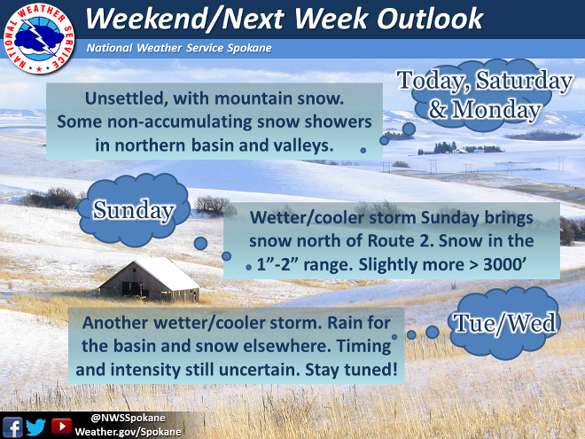 |
The National Weather Service, Spokane, says that
a very active weather regime is shaping up for
the next week for portions of North Idaho, North
Central Washington and Northeast Washington.
Periods of light snow with light to moderate
accumulations are possible each day Saturday
through Thursday. Stronger and better organized
storm systems on Sunday and again on or about
Wednesday will bring potentially heavy
accumulations of snow to the mountains and
passes surrounding the Columbia Basin.
The valleys of these mountain ranges will likely
receive at least moderate and possibly heavy
accumulations of snow from these storms.
In Bonners Ferry, snow is possible this
afternoon with a 70-percent chance overnight, a
50-percent chance with cooler temperatures on
Saturday increasing to 80-percent through the
day on Sunday and near to near 100-percent
overnight on Sunday, with an overnight low of
21-degrees going into the Monday morning
commute.
Three to five inches of new snow could be on the
ground Monday morning, with an additional two
inches of snow possible on Monday. Snowy weather
is expected to taper off next Thursday, though
skies are expected to stay mostly cloudy.
Snow in northwest Montana is expected to linger
into Friday. |
|
Questions or comments about this
letter?
Click here to e-mail! |
|
|
|
|